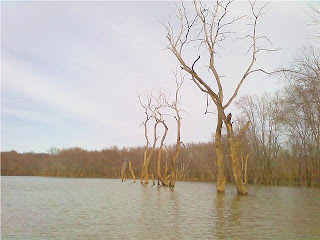
The past three weekends I've been on four paddling trips on four different bodies of water but they've all had one thing in common, high water and mud. All the waters in our area were affected by the snow melt off and resulting flooding, but the three dam created lakes that I've been on have really taken a hard hit.

Loyalhanna Lake & Infow Creek - 3/27/2010
I went to Loyalhanna last Saturday for a late afternoon paddle.I wanted to see how high the water was and I wanted to work my way upstream on the inflow creek a little farther than Robbin and I had gone in the fall. Someone had written on the Pittsburgh Kayakers website that the water level behind the dam was 32 feet above normal. I thought that it must have been a misprint.

A fellow kayaker, who was loading up when I was putting in, told me to keep track of the channels I was taking because it was easy to get turned around a lose your way with the water up. He also said that it was even higher the previous week. It was so high that the cliffs were under water and you could also look down into the osprey nest.

This is how the cliffs looked last fall.

The same cliffs as they looked on 3/27. They were underwater only a week earlier.

Keeping track of landmarks as I made my way upstream was really good advice. At one point I thought I was in the main creek channel only to come to a dead end. Fortunately I was able to paddle over what is normally dry ground to get back on course. It was a maze and I started looking ahead and behind to make sure I could find my way back. Check out my GPS track log in the Garmin Connect section in the side column. The Google map shows that I spent most of my trip paddling on land.

This photo shows that the 32 foot water level was probably pretty accurate. Check out the log tangled in the branches. It's about 20 feet off of the ground.

Mahoning Creek Lake 4/2/2010

This is the mud part of the story. I had never been to Mahoning Creek Lake but I've heard a lot about it. Robbin had to work on Friday, so I decided to go there early and make a day out of paddling new water. I left before 8 am to make the 40 minute drive to the lake. I had a pretty good idea where it was, where I wanted to launch from, and I had a semi-detailed map that I printed off of the Army Corp. of Engineers website (see Maps & Resources section). I made it to my projected starting point without a hitch, only to find it closed due to high water (imagine that). This is when I found out how semi detailed my map was. I started to drive to an alternative launch site and made a wrong turn. The area around Mahoning Creek Lake is very rural and most of the roads, it seemed, were unmarked dirt roads. I followed signs for the lake and ended up at the dam (not where I wanted to be). I back tracked and found the road I had missed (not the maps fault as it turns out. The problem was "trekker error"), but I didn't get on the water until a little past 10 am.

I headed upstream to start my journey. You can tell that this will be a beautiful place later in the spring. The hillsides, under the trees, are blanketed in Mountain Laurel and there are huge rocks every where. I was told by a friend, who lives in the area and canoes there regularly, that you can watch the eagles diving in and taking fish right in front of you. Right now though, it's just a sea of mud, rock, and tangled drift wood along the banks. I'm really looking forward to going back there in a few weeks,though. The leaves will be on the trees, the Mountain Laurel will be in bloom, the eagles will be fishing, and hopefully the mud will be gone.
You can find the track log for this trip in the Garmin Connect section.

Mountain Laurel is growing everywhere.

This guy wasn't too happy with me disturbing his fishing. I followed him up and down the creek for about a mile in each direction.

These riffles were the end of my journey upstream. I paddle about 100 yards through them but "ran out of steam". It was too early to be worn out so I turned around. As fortune would have it, had I put in at the launch I had originally wanted to use, I would have had to paddle through or portage around these riffles (in the mud) to get back to my truck. I guess it worked out for the best :-)


Hi Mark! You have discovered; like me,that you need to exercise additional caution when paddling in high water and muddy conditions. High water raises the concern for unseen underwater hazards - submerged logs, roots, rocks, etc. that can either dent your hull or even flip you out depending on paddle speed and angle that you meet a submerged object. Glad to see you getting back out on the water. It's always a bonus to have your wife with you too!
ReplyDelete